
CLARKSVILLE, TN (CLARKSVILLE NOW) – Another round of snow and ice is on the way to Clarksville this week.
“Light snow is possible tomorrow morning across the northwest (of Middle Tennessee), but the bulk of accumulations start tomorrow night into Thursday,” according to a National Weather Service alert.
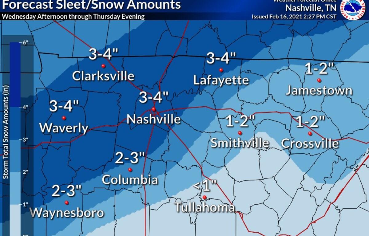
Heavy mixed precipitation is possible, with total snow accumulations of 3 to 4 inches and ice accumulations of around one tenth of an inch, the NWS said.
Montgomery and surrounding counties are under the watch from Wednesday afternoon through Thursday afternoon.
Travel could be very difficult on Thursday. The hazardous conditions could impact the morning or evening commute.
CMCSS and APSU have announced they’re going remote both days, and several other closings have been announced.
Snow forecast
Here’s the detailed NWS forecast:
Wednesday: Cloudy. Slight chance of light snow in the morning, then a chance of light snow possibly mixed with freezing rain in the afternoon. Snow accumulation up to around a half inch possible. Highs around 30. Northeast winds 5 to 10 mph. Chance of precipitation 50 percent. Lowest wind chill readings zero to 10 above zero in the morning.
Wednesday night: Light snow possibly mixed with freezing rain in the evening, then light snow after midnight. Snow accumulation of 1 to 2 inches. Lows in the mid 20s. Northeast winds 5 to 10 mph. Chance of precipitation 90 percent.
Thursday: Cloudy. Light snow likely in the morning, then light snow possibly mixed with freezing rain in the afternoon. Some snow accumulation possible. Highs in the lower 30s. North winds 5 to 10 mph. Chance of precipitation 70 percent.
Thursday night: Mostly cloudy. A 30 percent chance of light snow in the evening. Lows around 13. Northwest winds 5 to 10 mph.