
Update, 6:45 p.m.: Crews have made progress clearing thoroughfares and main routes, but many side roads and neighborhood streets still remain covered in ice and snow, according to a county news release.
More snow, an anticipated wintery mix of snow and rain combined with bitterly cold temperatures tonight and Thursday morning led city and county mayors to urge residents to stay home and off the roadways.
“It’s been several years since we’ve been hit this hard with harsh winter weather,” Montgomery County Mayor Durrett said. “Fortunately this does not happen often. It’s important to exercise caution when it does happen.”
“Although the road crews have worked diligently and will continue clearing roads, we still have black ice on the roads and in parking lots where citizens use services,” City Mayor Joe Pitts said.
Update, 3 p.m.: Montgomery and surrounding counties are now under a Winter Storm Warning, which has been moved three hours earlier. It remains in effect through 6 p.m. Thursday.
Update, 12:10 p.m.: A Winter Storm Warning is now in effect for Trigg, Todd, Lyon, Christian and Caldwell counties in Kentucky, lasting through 6 p.m. Thursday. The National Weather Service in Paducah, Kentucky, predicts 2 to 5 inches of snow for the Kentucky counties.

Previously:
CLARKSVILLE, TN (CLARKSVILLE NOW) – A Winter Storm Warning issued for Montgomery and surrounding counties starts at 6 p.m. today and continues through 6 p.m. Thursday.
Heavy mixed precipitation is expected, with total snow accumulations of 2 to 4 inches and ice accumulations up to 0.1 inches, according to the National Weather Service.
“Travel could be very difficult. The hazardous conditions could impact the morning or evening commute,” the alert said.
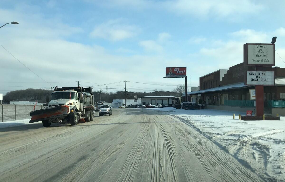
This morning, while main roads and many side roads were cleared yesterday, overnight single-digit lows have left patches of ice that may not melt until the sun goes to work on the salt.
Nearby Kentucky counties are under a Winter Storm Watch, with 1-3 inches of snow expected.
Clarksville forecast
Here’s what to expect the next few days.
Today: Cloudy with a 50 percent chance of snow showers. Snow accumulation up to a few tenths of an inch possible. Highs in the upper 20s. Northeast winds 5 to 10 mph.
Tonight: Snow showers possibly mixed with freezing rain. Snow accumulation of 1 to 2 inches. Near steady temperature in the mid 20s. Northeast winds 5 to 10 mph. Chance of precipitation 90 percent.
Thursday: Cloudy. Light freezing rain and snow showers likely in the morning, then a chance of light freezing rain and snow showers in the afternoon. Snow accumulation up to around a half inch possible. Total snow accumulation 1 to 3 inches. Highs in the lower 30s. North winds 5 to 15 mph. Chance of precipitation 70 percent.
Thursday night: Mostly cloudy. Lows around 14. Northwest winds 5 to 15 mph.
Friday: Partly sunny in the morning then clearing. Highs in the upper 20s. Northwest winds 5 to 10 mph.
Friday night: Partly cloudy. Lows around 9.
Saturday and Saturday night: Mostly clear. Highs in the upper 30s. Lows in the mid 20s.