
Update, 8:20 a.m. Monday: Sunday’s high reached just under 92 degrees, with a 103 heat index, at 3 p.m. at Clarksville Regional Airport.
Previously:
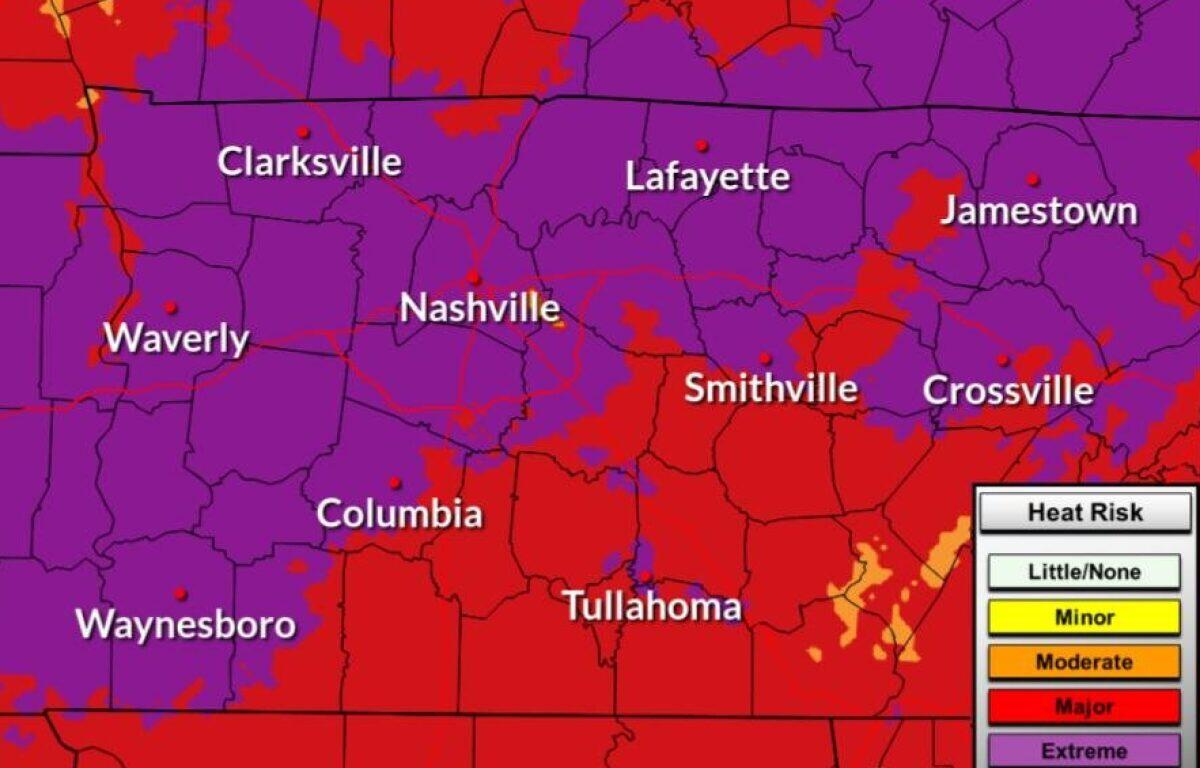
CLARKSVILLE, TN (CLARKSVILLE NOW) – With temperatures and humidity rising across Middle Tennessee today, the National Weather Service has issued a Heat Advisory for Sunday through 7 p.m., then an Extreme Heat Warning from 11 a.m. Monday until 8 p.m. Thursday.
On Sunday, heat index values up to 106 expected. Starting Monday, dangerously hot conditions are expected, with afternoon heat index values up to 110.
| MORE: What’s a heat index? Your guide to summer heat warnings
“Heat related illnesses increase significantly during extreme heat and high humidity events. Hot temperatures and high humidity may cause heat illnesses,” the NWS said. “Overnight lows will remain warm, only falling into the mid to upper 70s, this will bring limited relief from the heat especially to those that do not have air conditioning.”
“Drink plenty of fluids, stay in an air-conditioned room, stay out of the sun, and check up on relatives and neighbors.”
Clarksville forecast
Here’s the day-by-day outlook.
- Monday: Mostly sunny, with a high near 97, heat index up to 110, and a low around 76. Southwest wind around 2 mph.
- Tuesday: Sunny, with a high near 98 and a low around 76. Calm wind.
- Wednesday: Sunny, with a high near 98 and a low around 77. Calm wind.
- Thursday: A 10% chance of isolated thunderstorms. Mostly sunny, with a high near 98 and a low around 77. Calm wind.
- Friday: A 10% chance of isolated thunderstorms. Mostly sunny, with a high near 97 and a low around 78. Calm wind.
- Saturday: An 11% chance of showers. Partly sunny, with a high near 94 and a low around 77. Light south wind.
- Sunday: Showers likely, with an 86% chance of precipitation. High near 93 and a low around 76. Light south wind.
| WEATHER UPDATES: Click here for seven-day and hour-by-hour Clarksville weather forecasts