
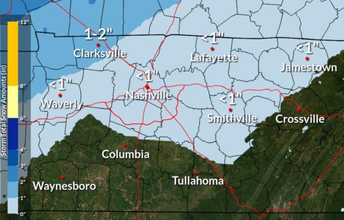
Update, 2 p.m.: A layer of frozen sleet and snow 3 inches thick is blanketing Clarksville, with light sleet still falling.
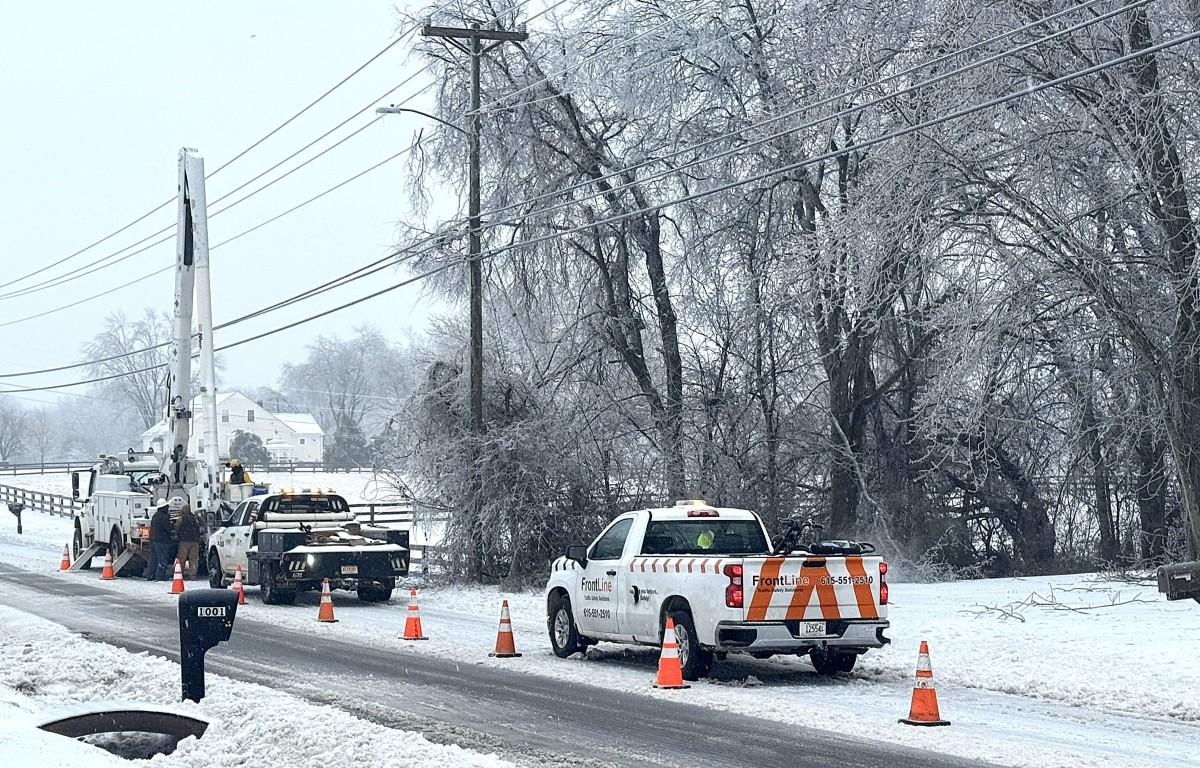
As of 1:15 p.m., around 32,000 CEMC members were without power across the five-county service area that includes Montgomery County. As additional damage occurs, these numbers may change.
Update, 11:30 a.m.: An Extreme Cold Warning has been issued by the NWS from 6 p.m. Monday to noon Tuesday. Dangerously cold wind chills as low as 10 below zero are expected.
Sunday night’s low is forecast at only 4 degrees, with a wind chill of -3. Monday’s high will reach only 16, with a wind chill of -8. Monday night’s low will be 0 degrees, with a wind chill of -11.
Update, 10:30 a.m.: CDE has 3,900 customers without power. “Crews are out in full force, working as quickly and safely as possible to restore service despite the icy conditions,” CDE said.
Sleet is continuing to fall, and wind gusts of 20-25 mph are expected Sunday afternoon, according to NWS, so power outages could worsen today.
Previously:
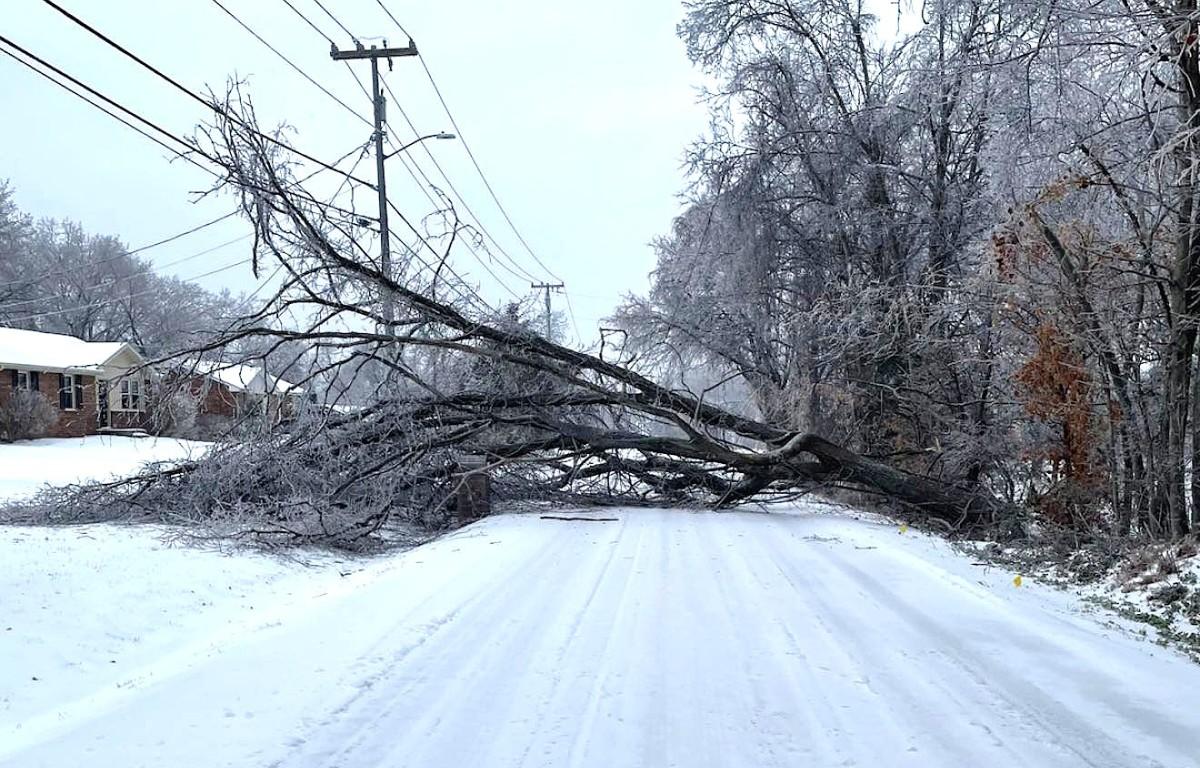
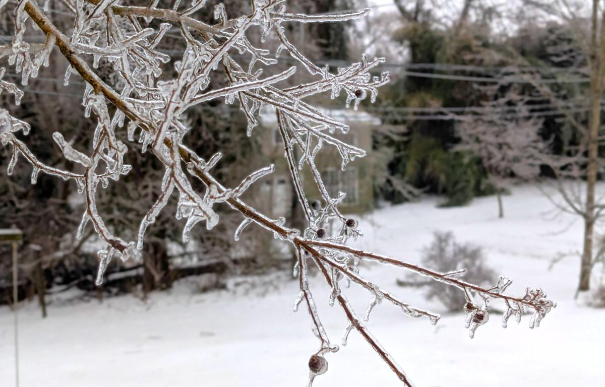
CLARKSVILLE, TN (CLARKSVILLE NOW) – About 2.5 inches of icy, crusty snow/sleet mix covered Clarksville Sunday morning, with sleet still falling. Branches were covered with a thin sheet of ice, leading to power outages across the city.
The wintry mix is expected to transition back to snow Sunday afternoon and evening, with an additional 1-2 inches of snow coming to Montgomery County, according to the National Weather Service.
“Freezing rain moved into the area overnight, creating dangerous conditions across the community. Many residents may not immediately realize what they are dealing with this morning, but trees, vehicles, power lines, and roadways are coated in a thick layer of ice,” said a statement from the Montgomery County Highway Department.
The ice continues to accumulate as of Sunday morning.
“Road conditions have deteriorated rapidly, with extremely slick surfaces making travel hazardous, even at low speeds,” the statement said. “We strongly encourage residents to remain indoors if at all possible, stay warm, and avoid unnecessary travel.”
Power outages in Clarksville
About 6,800 CDE customers were without power as of 8 a.m.
Outside Clarksville, there were 28,000 CEMC customers without power across Montgomery, Stewart, Robertson and Sumner Counties. The outage map was down, so county-level numbers were not available.
“Our crews are responding as conditions allow, but icy roads, falling trees, and downed lines may slow restoration,” CEMC said. “Safety for our lineworkers and the public always comes first, and we will work on restoration as it becomes safe to do so.”
| MORE: Snow closings: CMCSS closed Monday and Tuesday
Colder weather coming
The NWS has issued a Cold Weather Advisory from midnight Sunday through noon Tuesday, alerting that wind chills as low as 0 to 10 below expected.
“Wind chills as low as 10 below zero could result in hypothermia if precautions are not taken,” the alert said. “Use caution while traveling outside. Wear appropriate clothing, a hat, and gloves.”
We remain under a Winter Storm Warning for Montgomery and surrounding counties through 6 p.m. Sunday. Gov. Bill Lee has issued a State of Emergency for all 95 counties.
| MORE: For road conditions, click here for live Clarksville traffic cameras
Clarksville forecast
Here’s the day-by-day outlook into next week.
- Today: Snow showers, freezing rain and sleet before 3 p.m., then a slight chance of snow showers and sleet between 3 and 4 p.m. Sleet may be heavy at times. High near 26. Northwest wind 10 to 15 mph, with gusts up to 20 mph. Chance of precipitation is 100%. Total daytime ice accumulation of 0.1 to 0.3 of an inch possible. Total daytime snow and sleet accumulation of less than 1 inch possible.
- Tonight: Cloudy, then gradually becoming partly cloudy, with a low around 4. Wind chill values as low as minus 3. Northwest wind 5 to 10 mph, with gusts up to 20 mph.
- Monday: Sunny with a high near 16. Wind chill values as low as minus 8. Northwest wind 5 to 10 mph.
- Monday night: Mostly clear with a low around 0. Wind chill values as low as minus 11. Calm wind becoming south-southwest around 5 mph after midnight.
- Tuesday: Sunny with a high near 31. West-southwest wind 5 to 15 mph, with gusts up to 20 mph.
- Tuesday night: Patchy fog after 2 a.m. Otherwise, partly cloudy with a low around 6. West wind around 5 mph becoming calm in the evening.
- Wednesday: Patchy fog before 9 a.m. Otherwise, mostly sunny with a high near 26. Calm wind becoming west-northwest around 5 mph in the afternoon.
- Wednesday night: Mostly cloudy with a low around 3. West wind around 5 mph.
- Thursday: Mostly sunny with a high near 24. North-northwest wind around 5 mph.
- Thursday night: Mostly cloudy with a low around 4.
- Friday: Partly sunny with a high near 27.
- Friday night: Mostly cloudy with a low around 3.
- Saturday: Mostly sunny with a high near 23.
MORE:
- Snow removal: Which roads will be plowed first?
- 7 most dangerous roads for winter weather wrecks
- Jeep Crew: Efforts coordinated with police, Sheriff’s Office | COMMENTARY
- Winter weather: How to handle ice and snow in Clarksville
- Warming shelters open over weekend, volunteers needed
| DOWNLOAD THE APP: Sign up for our free Clarksville Now app