
Update, 3:35 p.m.: The NWS is now predicting 6-8 inches of snow for Clarksville, with the most likely outcome 6.2 inches, according to the 2:30 p.m. forecast.
At the direction of Gov. Bill Lee, TEMA Director Patrick C. Sheehan issued a State of Emergency to provide regulatory relief due to winter weather in Tennessee. The Tennessee Emergency Management Agency encourages all Tennesseans to take preparedness steps ahead of a significant winter storm, with impacts expected Thursday evening through Saturday afternoon.

Update, 1:50 p.m.: The timing of the snow’s arrival has moved up an hour, and now expected in Clarksville at 6 a.m., according to the NWS. Snow could come as early as 4 a.m. or as late as 8 a.m. Snowfall should end in Clarksville at 9 p.m. It could end as early as 7 p.m. or as late as 11 p.m.
Update, 10:50 a.m.: The “peak melting days” will be Sunday and Monday, according to the NWS. Sunday’s high should be near 40, and Monday’s high in the upper 30s.
MORE: Snow closings: Schools, library, city and county offices closed Friday
LIVE VIDEO: Click here to see road conditions Friday on Clarksville traffic cameras
Previously:
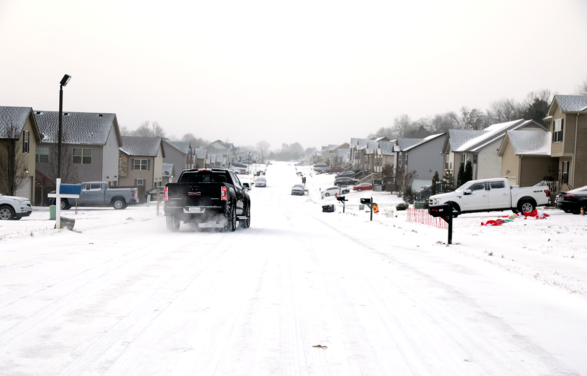
CLARKSVILLE, TN (CLARKSVILLE NOW) – The snow alert from the National Weather Service has been upgraded to a Winter Storm Warning, from 3 a.m. Friday to 6 a.m. Saturday.
“Plan on slippery roads and difficult travel conditions,” the Warning said. “The hazardous conditions could impact the Friday morning and evening commutes. If you must travel, keep an extra flashlight, food, water, and warm clothes in your vehicle in case of an emergency.”
Clarksville is expected to get 4 to 6 inches of snow. To narrow that down, there’s a 73% chance Clarksville will get over 3 inches of snow, and about a 30% chance we’ll get over 5 inches, according to the NWS.


Snowfall is most likely to start in Clarksville at 7 a.m. Friday, but it could start as early as 4 a.m. or as late as 10 a.m., the NWS said. Roads will begin to become snow-covered and slippery Friday morning. By Friday afternoon, we’ll have major travel issues with slippery and snow-covered roads. Travel impacts will remain into Saturday.
MORE: Clarksville residents asked to stay off roads Friday if possible, snow plows on standby
Warming shelter
Anyone needing a place to get warm can go to the Clarksville Area Urban Ministries warming shelter at the Madison Street UMC Gymnasium, 300 Commerce St.
Anyone who is homeless can get on any City of Clarksville bus and tell the driver you need a ride to the shelter. They will take you there free.
The shelter is in need of help with volunteers and donations:
Clarksville forecast
Here’s the day-by-day outlook.
- Today: Sunny, with a high near 36. Calm wind.
- Tonight: A 30 percent chance of snow showers after 4am. Increasing clouds, with a low around 25. Calm wind. New snow accumulation of less than a half inch possible.
- Friday: Snow showers. High near 33. Calm wind becoming southeast around 5 mph. Chance of precipitation is 100%. New snow accumulation of 3 to 5 inches possible.
- Friday night: A 30 percent chance of snow showers before midnight. Cloudy, with a low around 25. Calm wind becoming west northwest around 5 mph after midnight.
- Saturday: Partly sunny, with a high near 34. West northwest wind around 5 mph becoming southwest in the afternoon.
- Saturday night: Partly cloudy, with a low around 18. Calm wind becoming south around 5 mph.
- Sunday: Sunny, with a high near 40. South southwest wind 5 to 10 mph.
- Sunday night: Mostly cloudy, with a low around 27. South southwest wind around 5 mph becoming west after midnight.
- Monday: Partly sunny, with a high near 35. West northwest wind 5 to 10 mph.
- Monday night: Partly cloudy, with a low around 16.
- Tuesday: Mostly sunny, with a high near 31.
- Tuesday night: Partly cloudy, with a low around 18.
WEATHER UPDATES: Click here for seven-day and hour-by-hour Clarksville weather forecasts