
Update, 5:30 p.m.: The latest National Weather Service forecast has the low tonight around 6 degrees. Wind chill readings could bring that to 4 below zero.
Friday’s high will stay below freezing, reaching only the upper 20s. Friday night will be bring lows around 16 degrees.
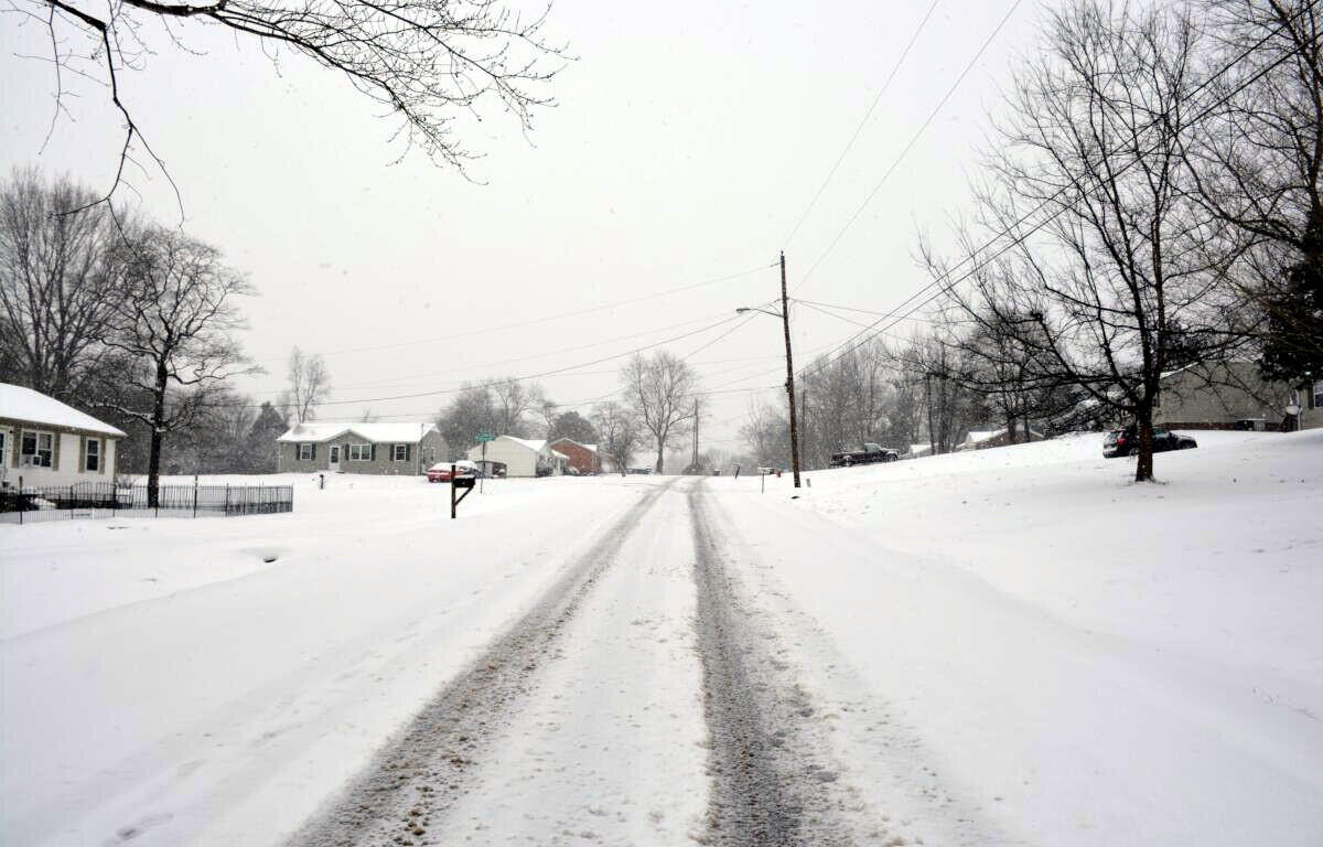
Update, 1:30 p.m.: The snow should start tapering off this afternoon, with most of it stopped by 4 or 5 p.m. in Clarksville. “But that doesn’t mean things are going to get better,” according to meteorologist Sam Herron at the National Weather Service.
“Temperatures behind the snow – which will probably pile up to anywhere from 4 to 6 inches – those temperatures are going to be plummeting through the teens and even some single digits by daybreak,” Herron told Clarksville Now. “So whatever is out there is going to stay out there, and there may even be some problems with some of the main roads even getting some icy spots on it as we try to recover on Friday.
“It’s going to be a travel mess all through the night and through at least Friday morning,” he said.
“Some improvement is on the way after that with the sun coming out, but actual temperatures aren’t even going to reach freezing on Friday, so we may keep the snow around into Saturday as well,” Herron said.
Things should warm up over the weekend.

Previously:
CLARKSVILLE, TN (CLARKSVILLE NOW) – We’re expected to get 4-5 inches of snow today in Montgomery and surrounding counties, and the area is under a Winter Storm Warning until 8 p.m.
Schools, Fort Campbell and state offices are closed, and Gov. Bill Lee has urged everyone to avoid travel today.

“Snow is expected to spread across the area this morning and continue through the afternoon before ending,” according to the National Weather Service. “Snow accumulations of 3 to 5 inches, with higher amounts possible, are anticipated along and north of I-40.”
“Hazardous travel conditions are expected to develop during the day today and worsen tonight as temperatures drop into the teens and single digits. Roads will likely remain hazardous Friday into Saturday morning as temperatures stay below freezing.”

Following the snow and single-digit temperatures in Clarksville, widespread showers and a few thunderstorms are expected Saturday night into Sunday, with 1 to 2 inches of rain possible.
“These rainfall amounts combined with snow melt may cause localized flooding issues, as well as rises on area rivers,” NWS said.
CLOSURES: Gov. Lee closes offices, urges residents to avoid non-essential travel today
MORE: Shelters, warming center opened ahead of snow in Clarksville
Clarksville forecast
Here’s the day-by-day outlook.
Today: Colder. Snow until late afternoon, then a chance of light snow late in the afternoon. Snow may be heavy at times until late afternoon. Snow accumulation of 3 to 5 inches. Highs in the upper 20s. North winds 5 to 10 mph. Chance of snow near 100 percent.
Tonight: Mostly cloudy in the evening then becoming partly cloudy. Lows around 8. Northwest winds up to 10 mph. Wind chill readings 3 below to 7 above zero.
Friday: Partly cloudy. Highs in the upper 20s. Northwest winds up to 5 mph shifting to the northeast in the afternoon. Lowest wind chill readings 3 below to 7 above zero in the morning.
Friday night: Mostly clear. Lows around 16. East winds up to 5 mph.
Saturday: Not as cool. Partly cloudy. Highs in the upper 40s. South winds 5 to 15 mph.
Saturday night: Not as cool. Showers and slight chance of thunderstorms. Lows in the lower 40s. Chance of precipitation near 100 percent.
Sunday: Cloudy. Rain showers and slight chance of thunderstorms in the morning, then a chance of rain showers in the afternoon. Highs in the lower 50s. Chance of precipitation 90 percent.
Sunday night: Colder. Mostly cloudy in the evening then becoming partly cloudy. Lows in the lower 20s.