


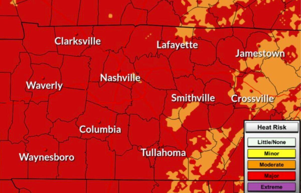

Update, 11 p.m.: An Extreme Heat Warning has been issued through 8 p.m. Tuesday. Dangerously hot conditions with heat index values up to 112 are expected, according to the NWS.
Previously:
CLARKSVILLE, TN (CLARKSVILLE NOW) – Dangerous heat will continue to start the week, with heat index values reaching as high as 115 degrees before slightly cooler and drier air arrives midweek.
The National Weather Service has issued a Heat Advisory through 8 p.m. Tuesday. “Drink plenty of fluids, stay in an air-conditioned room, stay out of the sun, and check on relatives and neighbors.”
Isolated afternoon showers and thunderstorms remain possible Monday and Tuesday, but sunshine and more comfortable temperatures are expected for the second half of the week.
Clarksville forecast
Here’s the day-by-day outlook.
- Saturday: A 30% chance of showers and thunderstorms. Mostly sunny, with a high near 86.
- Monday: A chance of showers, with thunderstorms also possible after 1 p.m. Patchy fog before 7 a.m. Otherwise, mostly sunny, with a high near 95. Heat index values as high as 115. Calm wind becoming north northwest around 5 mph in the afternoon. Chance of precipitation is 30%.
- Monday night: Mostly clear, with a low around 77. West southwest wind 5 to 10 mph.
- Tuesday: A 30% chance of showers and thunderstorms after 1 p.m. Sunny, with a high near 95. West wind around 10 mph, with gusts as high as 20 mph.
- Tuesday night: A slight chance of showers and thunderstorms before 10 p.m., then a slight chance of showers between 10 p.m. and 1 a.m. Partly cloudy, with a low around 71. North wind 5 to 10 mph. Chance of precipitation is 20%.
- Wednesday: Sunny, with a high near 89. North wind 5 to 10 mph.
- Wednesday night: Mostly clear, with a low around 66. North wind 5 to 10 mph becoming light in the evening.
- Thursday: Sunny, with a high near 90. Calm wind becoming north northeast around 5 mph in the morning.
- Thursday night: Partly cloudy, with a low around 67.
- Friday: Mostly sunny, with a high near 90.
- Friday night: A 20% chance of showers and thunderstorms. Partly cloudy, with a low around 69.
| WEATHER UPDATES: Click here for seven-day and hour-by-hour Clarksville weather forecasts