



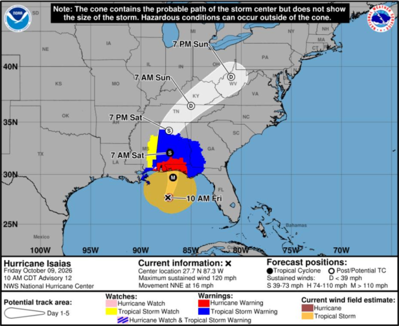
CLARKSVILLE, TN (CLARKSVILLE NOW) – Good news if you didn’t want all that rain: The projected path for the remnants of Hurricane Isaias has shifted to the east, on a trajectory that could bypass Clarksville completely.
As of 4 p.m. Friday, the storm’s path was centered toward Knoxville, and it had slowed to still be in north Alabama at 7 p.m. Saturday, according to the National Weather Service.
Montgomery County is likely to get only .5 to 1 inch of rain out of the storm.
A Wind Advisory remains in effect from 4 a.m. to 8 p.m. Saturday, with winds 15-25 mph and gusts up to 45 mph expected.
Clarksville forecast
Here’s the day-by-day outlook.
- Saturday: Showers and possibly a thunderstorm. High near 70. East-northeast wind 5 to 10 mph, increasing to 15 to 20 mph in the afternoon. Winds could gust as high as 35 mph. Chance of precipitation is 100%. New rainfall amounts between a quarter and half of an inch possible.
- Saturday night: Showers and possibly a thunderstorm before 3 a.m., then a chance of showers after 5 a.m. Low around 61. East-northeast wind 10 to 15 mph becoming southeast 5 to 10 mph after midnight. Winds could gust as high as 30 mph. Chance of precipitation is 90%. New precipitation amounts between a tenth and quarter of an inch, except higher amounts possible in thunderstorms.
- Sunday: A 30% chance of showers, mainly before 7 a.m. Partly sunny, with a high near 73. South-southwest wind 5 to 15 mph becoming west in the afternoon. Winds could gust as high as 20 mph.
- Sunday night: Mostly clear, with a low around 59. West wind around 5 mph becoming calm in the evening.
| WEATHER UPDATES: Click here for seven-day and hour-by-hour Clarksville weather forecasts