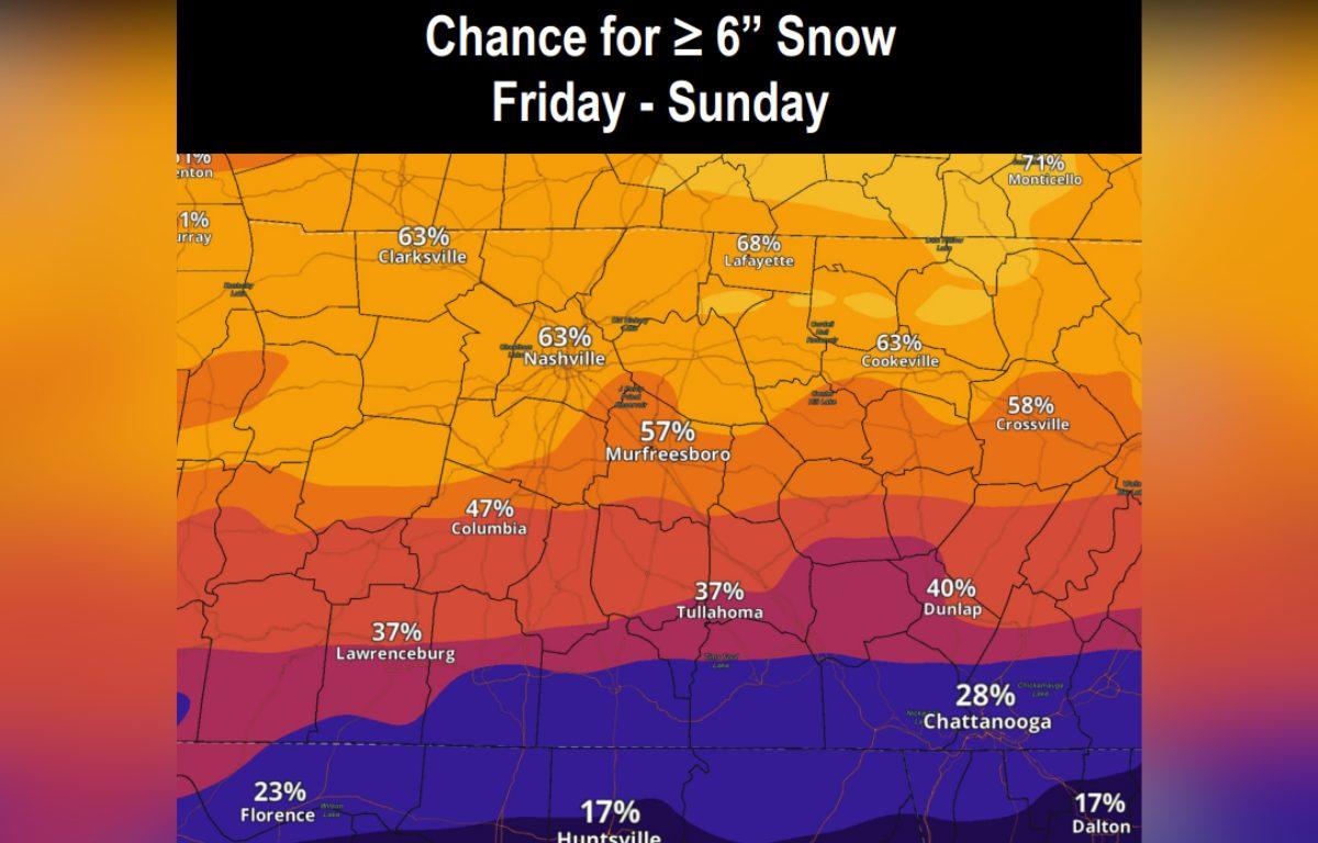

CLARKSVILLE, TN (CLARKSVILLE NOW) – With over 6 inches of snow expected, a Winter Storm Watch has been issued for Clarksville from Friday evening through Sunday afternoon.
“While there still remains uncertainty regarding specific snow and ice totals, forecaster confidence is increasing in significant impacts,” the National Weather Service said.
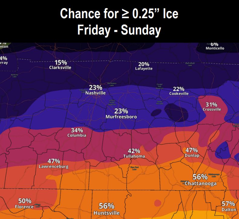
There’s a 15% chance that Montgomery County could also get a quarter inch of ice. Ice is expected to be worse south of Interstate 40.
The snow won’t go anywhere soon: Temperatures will free-fall this weekend, with the coldest mornings Monday and Tuesday in single-digit temperatures. “This long period of sub-freezing temperatures may prolong winter storm impacts into early next week,” the NWS said.
| MORE: 7 most dangerous roads for winter weather wrecks in Clarksville
| MORE: Winter weather: How to handle ice and snow in Clarksville
Clarksville forecast
Here’s the day-by-day outlook.
- Thursday: Mostly sunny with a high near 45. Calm wind becoming north-northeast around 5 mph.
- Thursday night: Mostly cloudy with a low around 26. North-northeast wind 5 to 10 mph.
- Friday: A 20% chance of snow after noon. Mostly cloudy with a high near 32. North wind 10 to 15 mph, with gusts up to 20 mph.
- Friday night: A 40% chance of snow, mainly after midnight. Cloudy with a low around 12. North-northeast wind around 10 mph, with gusts up to 20 mph.
- Saturday: Snow, possibly heavy at times. High near 20. Northeast wind around 10 mph, with gusts up to 20 mph. Chance of precipitation is 80%.
- Saturday night: Snow showers with a low around 15. North-northeast wind 5 to 10 mph. Chance of precipitation is 90%.
- Sunday: A 40% chance of snow showers. Mostly cloudy with a high near 23. North wind 5 to 10 mph.
- Sunday night: Mostly cloudy with a low around 4.
- Monday: Mostly sunny with a high near 24.
- Monday night: Mostly clear with a low around 2.
- Tuesday: Sunny with a high near 32.
| WEATHER UPDATES: Click here for seven-day and hour-by-hour Clarksville weather forecasts