
NASHVILLE, Tenn. (CLARKSVILLENOW) – Storm survey teams with the National Weather Service (NWS) in Nashville said two tornadoes touched down in Tennessee Wednesday, Feb. 6 during severe storms.
RELATED: Flash flood warning, wind advisory issued for Montgomery County
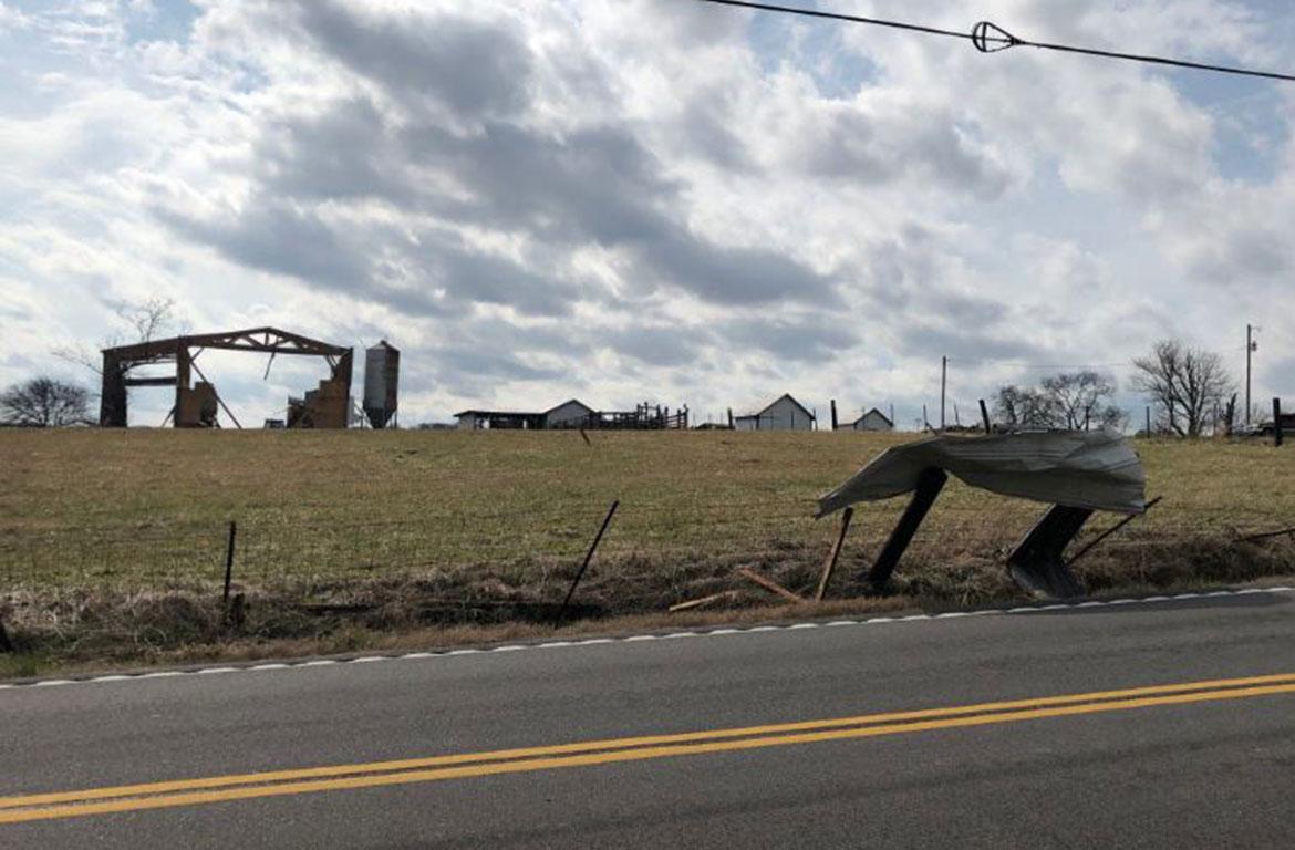
A storm survey team determined an EF-0 tornado touched down along West Trimble Road just south of Milton in Rutherford County Wednesday.
One large barn west of Halls Hill Pike was destroyed, with debris from the barn blown up to 500 yards away. Two homes along Halls Hill Pike received minor roof damage, an outbuilding lost part of its roof, and a carport was destroyed.
Dozens of trees were snapped and uprooted along the narrow path. An EF0 tornado is considered to be the weakest on the scale, with winds of 65 to 85 mph.
Our storm survey team determined an EF-0 #tornado with max winds around 80 mph touched down yesterday just south of Milton in Rutherford County. The tornado was on the ground for 1.2 miles and was 75 yards wide. Read more info at: https://t.co/fkFDJAmusV #tnwx pic.twitter.com/G8toETw2xD
— NWS Nashville (@NWSNashville) February 7, 2019
In Wilson County, a small, weak tornado touched down along Trousdale Ferry Pike just west of Tuckers Crossroads and curved northeast before lifting near Big Springs Road Wednesday night.
One barn at the beginning of the path was destroyed with debris blown up to one half mile away. One home and some trees across the street received minor damage.
A few more trees were blown down in fields west of Big Springs Road before the tornado lifted.
No injuries were reported in either storm.
Our storm survey team also determined another brief, weak EF-0 #tornado touched down near Tuckers Crossroads in eastern Wilson County last night. One barn was destroyed with debris blown up to 1/2 mile away, and several trees were blown down. More info at https://t.co/fkFDJAmusV pic.twitter.com/hryHXUvfQj
— NWS Nashville (@NWSNashville) February 7, 2019