
Update, 8 p.m.: The Ice Storm Warning has been extended through 6 a.m. Friday.
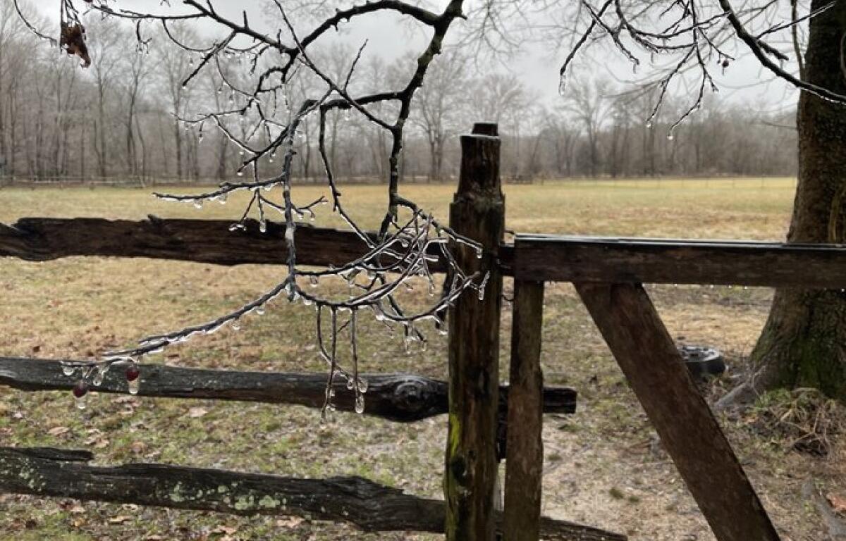
Significant icing expected, according to the NWS. Ice accumulation of around .25 inches is possible.
Update, 6:30 p.m.: While the freezing rain hasn’t hit Clarksville as soon as feared, it is likely still on the way.
“It’s been in transition all day long,” NWS meteorologist Sam Herron told Clarksville Now. “That colder air is going to be seeping in here finally this evening, and we’ll get more of that transition.”
The trick, Herron said, will be how soon the cold air arrives before the precipitation ends.
“Everybody will need to be looking out for some slick spots on through Friday morning as the clouds, the patchy drizzle and the cold temperatures hang around.”
Update, 4 p.m.: Manna Café is requesting volunteers to help staff their emergency warming center, in the Refuge Outreach Center at 503 D St.
Co-founder Vicki York explains, “The center is run almost exclusively by volunteers, and our core team is often exhausted. But it’s a crucial service, ensuring that the homeless aren’t forced to tough it out in life-threatening conditions.”
Volunteer coordinator Kim Holbrook adds, “We appreciate every hour anyone can help us serve our less fortunate neighbors. All you have to do is sit with people, help them check in, maybe serve some coffee or food, and have a chat.”
Anyone interested should log onto MannaCafeMinistries.com/volunteer.
Donations of warming center items are also appreciated. These include Ramen noodles, toilet paper, bottled water, instant oatmeal, peanut butter crackers, and gently used warm clothes, towels, and blankets.
Update, 3 p.m.: Heavy rain has caused flooding on Lylewood Road near Woodlawn Park Road, and on Salem Road between Rocky Ford and Ferry Road, according to the Montgomery County Sheriff’s Office.
Update, 2:15 p.m.: Areas in Stewart County are starting to see ice accumulation on trees and power lines, according to Cumberland Electric Membership Corp.
“Crews from all CEMC districts are on alert and prepared to handle potential impacts to our power system,” CEMC said.
Report any CEMC outages through their SmartHub app or by calling 800-987-2362.
Update, 11:50 a.m.: CDE Lightband said their crews are on standby to help their 76,000 customers if ice causes trees to fall on powerlines or bend wires.
CDE’s Keith Cutshall said power companies are much more concerned with ice than snow. The ice is heavier, and it only takes about a quarter of an inch to cause problems.
“The ice accumulates on it and it will sag the wire down, and eventually it will break the lines and cause outages,” Cutshall told Clarksville Now news partner WKRN.
The Tennessee Department of Transportation said it is prepared to treat roads if they become slick and icy.
They can pour salt, even with all the rain, on roadways to help create safer conditions.
Update, 9:45 a.m.: The Ice Storm Warning time has been moved up and will be in effect starting at 10 a.m.
Ice is starting to build up across Land Between the Lakes, according to LBL staff reports.
Previously:
CLARKSVILLE, TN (CLARKSVILLE NOW) – An Ice Storm Warning has been issued for Montgomery County from 3 p.m. today through 1 a.m. Friday. The warning also includes Stewart, Houston and Humphreys counties.
Significant icing is expected, particularly around Clarksville, Dover and Erin, according to the National Weather Service, with ice accumulation of between 0.25 inches and 0.4 inches. Total sleet and snow accumulations of up to 1 inch are expected.

“Travel will be dangerous, if not impossible, through Friday,” the NWS said. “Downed trees and power outages expected.”
The ice storm forecast has prompted several early closings, including a half-day for Clarksville-Montgomery County Schools.
“If you must travel, keep an extra flashlight, food and water in your vehicle in case of an emergency. Prepare for possible power outages.”
For local severe weather alerts and updates, tune in to radio stations Beaver 100.3, Q108, Z97.5, Rewind 94.3 or NewZee 105.5.
Clarksville forecast
Here’s the day-by-day outlook.
Today: Rain possibly mixed with freezing rain. Ice accumulation of up to one tenth to one quarter of an inch. Highs in the mid 30s. North winds 10 to 20 mph. Chance of precipitation near 100 percent.
Tonight: Cloudy. Light freezing rain possibly mixed with snow in the evening, then a chance of light snow possibly mixed with freezing rain after midnight. Snow accumulation up to 1 inch. Ice accumulation of less than one tenth of an inch. Lows in the mid 20s. North winds 10 to 20 mph. Chance of precipitation 70 percent.
Friday: Cloudy in the morning then becoming partly sunny. Highs in the lower 30s. North winds 10 to 15 mph.
Lee Erwin contributed to this report.