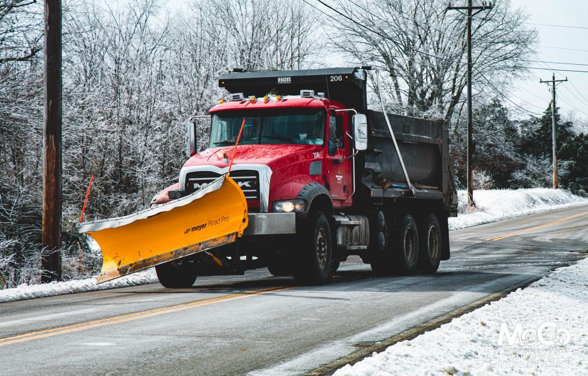

Update, 3:30 p.m.: The Montgomery County Highway Department said their crews now have all primary routes complete and have made “strong progress” on secondary routes.
“The combination of nearly 2 inches of ice and significant snowfall has made some areas especially difficult to clear, and there are still spots that remain very slick,” MCHD said. “Sunshine over the past few days has helped during daylight hours, but melting often refreezes quickly once temperatures drop at night.”


Some may notice trucks driving through an unplowed area without plowing, but there’s a reason for that: “Because secondary roads see less traffic, which helps break up snow and ice and makes it easier to plow, we typically salt those roads first and let it soften up the ice and snow before we can plow.”
Highway crews have been on the job since Saturday, working 16-hour shifts to clear the roads. “With even colder temperatures and a chance of additional snowfall expected this weekend, our crews will continue working through the weekend to keep roads as clear and passable as conditions allow.
| MORE: 9,000 tons of salt, 5,000 man hours: Clarksville ice/snow removal by the numbers
“We ask everyone to remain cautious, slow down, and give road crews plenty of space to work. Your patience and support truly matter, and we are grateful to serve a community that looks out for one another.”
Update, 9:30 a.m.: Montgomery County Mayor Wes Golden said the state will be sending 35 additional TDOT trucks to clear highways of packed ice and snow.


Previously:
CLARKSVILLE, TN (CLARKSVILLE NOW) – Temperatures will warm somewhat today, reaching 36 in Clarksville, but another blast of frigid air will spread into the region beginning Friday.
We can expect to spend 60-70 consecutive hours below freezing this weekend, according to the National Weather Service. Overnight lows will be in the single digits Friday and Saturday with below zero wind chills.
There is a slight chance for a dusting of snow Friday through Saturday, and freezing fog is possible at night, especially where ice and snow remain. “Continue to use caution if traveling this week as slick and icy spots will persist!” the NWS said.
| MORE: Snow closings: CMCSS, APSU campus closed for rest of week
Road conditions, bus service in Clarksville
While the main roads in Clarksville are mostly clear, many side streets are still covered in packed ice. The bigger issue is with driveways, sidewalks and parking lots. Also, be alert for pedestrians, and some have been seen walking on major roadways because sidewalks are blocked with plowed-up snow.
Clarksville Transit System will operate reduced service on Thursday and Friday. Bus and Paratransit “The Lift” will provide service 9 a.m.-5 p.m. Administrative offices will remain closed. Note that this reduced service is modified from previously posted snow routes to reflect current road conditions. Some routes may be shortened, detoured, or temporarily bypass certain areas. Click here for Thursday CTS routes.
| MORE: For road conditions, click here for live Clarksville traffic cameras
Clarksville forecast
Here’s the day-by-day outlook into next week.
- Today: Mostly cloudy with a high near 36. Calm wind becoming east-southeast around 5 mph.
- Tonight: Cloudy with a low around 22. Northeast wind around 5 mph.
- Friday: Cloudy, then gradually becoming mostly sunny with a high near 30. North wind 5 to 10 mph.
- Friday night: A 20% chance of snow showers before midnight. Mostly cloudy with a low around 9. Wind chill values as low as minus 4. North-northwest wind around 10 mph.
- Saturday: Partly sunny with a high near 20. North-northwest wind 10 to 15 mph, with gusts up to 20 mph.
- Saturday night: Mostly cloudy with a low around 7. North-northwest wind 5 to 10 mph becoming light northwest after midnight.
- Sunday: Partly sunny with a high near 28. Calm wind becoming northwest around 5 mph.
- Sunday night: Mostly cloudy with a low around 15. Calm wind becoming south around 5 mph after midnight.
- Monday: Partly sunny with a high near 39. West-southwest wind 5 to 10 mph.
- Monday night: Mostly cloudy with a low around 24.
- Tuesday: Mostly cloudy with a high near 42.
- Tuesday night: A 30% chance of showers. Mostly cloudy with a low around 27.
- Wednesday: A 30% chance of showers. Mostly cloudy with a high near 40.
MORE:
- Where to get warm, get help during ice storm in Clarksville
- Inside Clarksville Jeep Crew’s over 275 assists | PODCAST
- 7 most dangerous roads for winter weather wrecks
- Winter weather: How to handle ice and snow in Clarksville
| DON’T MISS A LOCAL STORY: Sign up for the free daily Clarksville Now email newsletter