
Update, 7:45 a.m. Monday: The Cumberland has dropped to minor flood stage, at 49.79 feet as of 6 a.m.
The Red River crested at 39.3 feet Sunday evening. It has also dropped to minor flood stage, at 37.71 feet as of 6:30 a.m.
Update, 9:30 p.m.: The Cumberland River crested in Clarksville at 50.54 feet at 7 p.m. At 8 p.m., it had lowered to 50.48 feet and was dropping.
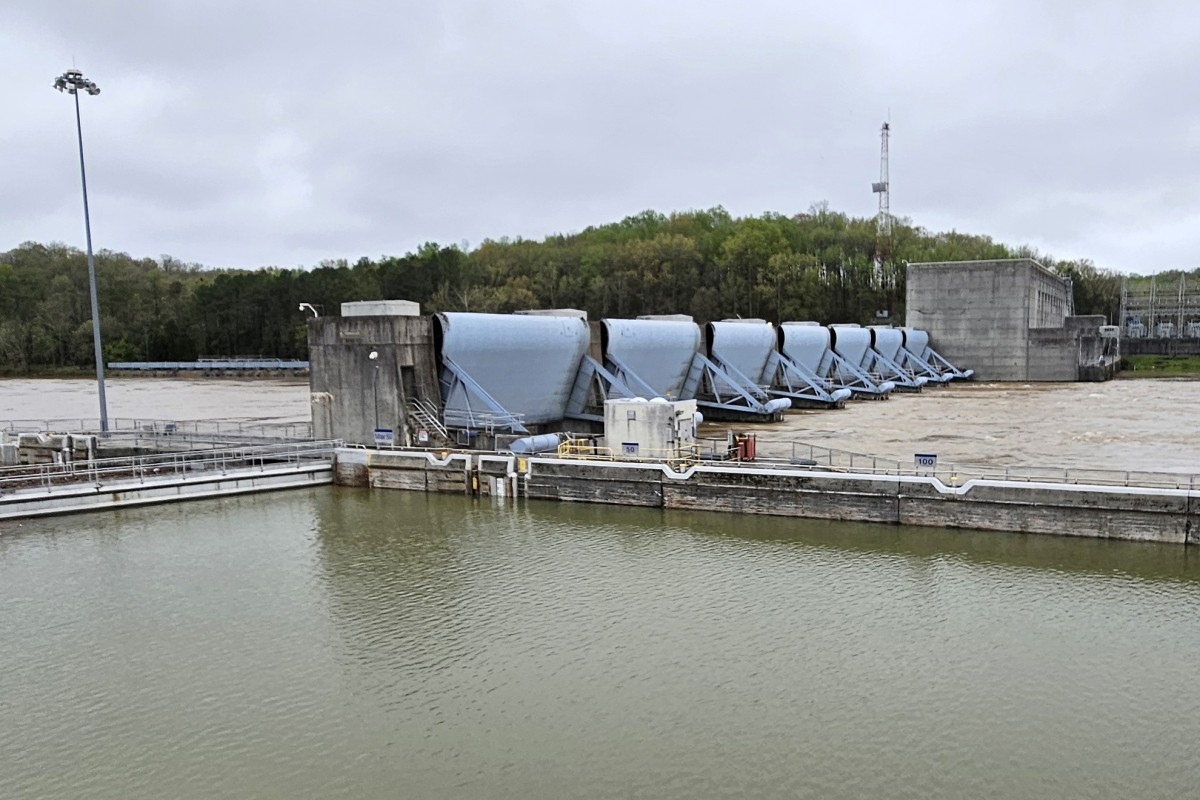
Update, 4 p.m.: As storms begin to move out of the Cumberland River Basin, the U.S. Army Corps of Engineers Nashville District has begun releasing water from its flood control dams upstream from Nashville.
“As has been the case with this event, the primary focus and problem areas are downstream of Nashville,” said Robert Dillingham, hydraulic engineer in the Nashville District Water Management Section. “The river in Nashville is cresting and we have no further concerns in this area.”
Dillingham said over the past several days, Cordell Hull Lake, Old Hickory Lake, and J. Percy Priest Lake received between 3.5 and 4.5 inches of rainfall, but downstream areas like Cheatham Lake received 6.5 inches of rain and Lake Barkley totaled nearly 10 inches of rain.
Water managers are balancing efforts to hold and release water through the dams to reduce flood risks, support safe navigation, and keep the public informed as conditions evolve, the release said.
“We have stored lots of water at our storage projects and those pools are rising. In the coming days and weeks, we will ramp up releases from those lakes to recover storage,” Dillingham said in the release. “As downstream unregulated conditions begin receding, we are going to start making controlled releases from our upstream dams.”
As of 3 p.m., the Cumberland in Clarksville was at 50.42 feet and rising. It’s expected to crest this evening at 50.7 feet.
| MORE: Farmington and Woodstock neighborhoods evacuated | PHOTOS, VIDEO
Previously:
CLARKSVILLE, TN (CLARKSVILLE NOW) – A Flood Warning has been issued for the Cumberland River at Clarksville, and flood waters are expected to reach Riverside Drive this afternoon.
There’s also a Flood Warning for the Red River at Port Royal. Both warnings are in effect until Tuesday evening.
The U.S. Army Corps of Engineers is holding back water at the dams in the Cumberland River Basin to prevent flooding farther downstream in Nashville and Clarksville. The only dam between Nashville and Clarksville is Cheatham Dam, just upstream from Clarksville, but it does not have a flood storage system and must release the water that runs into it.
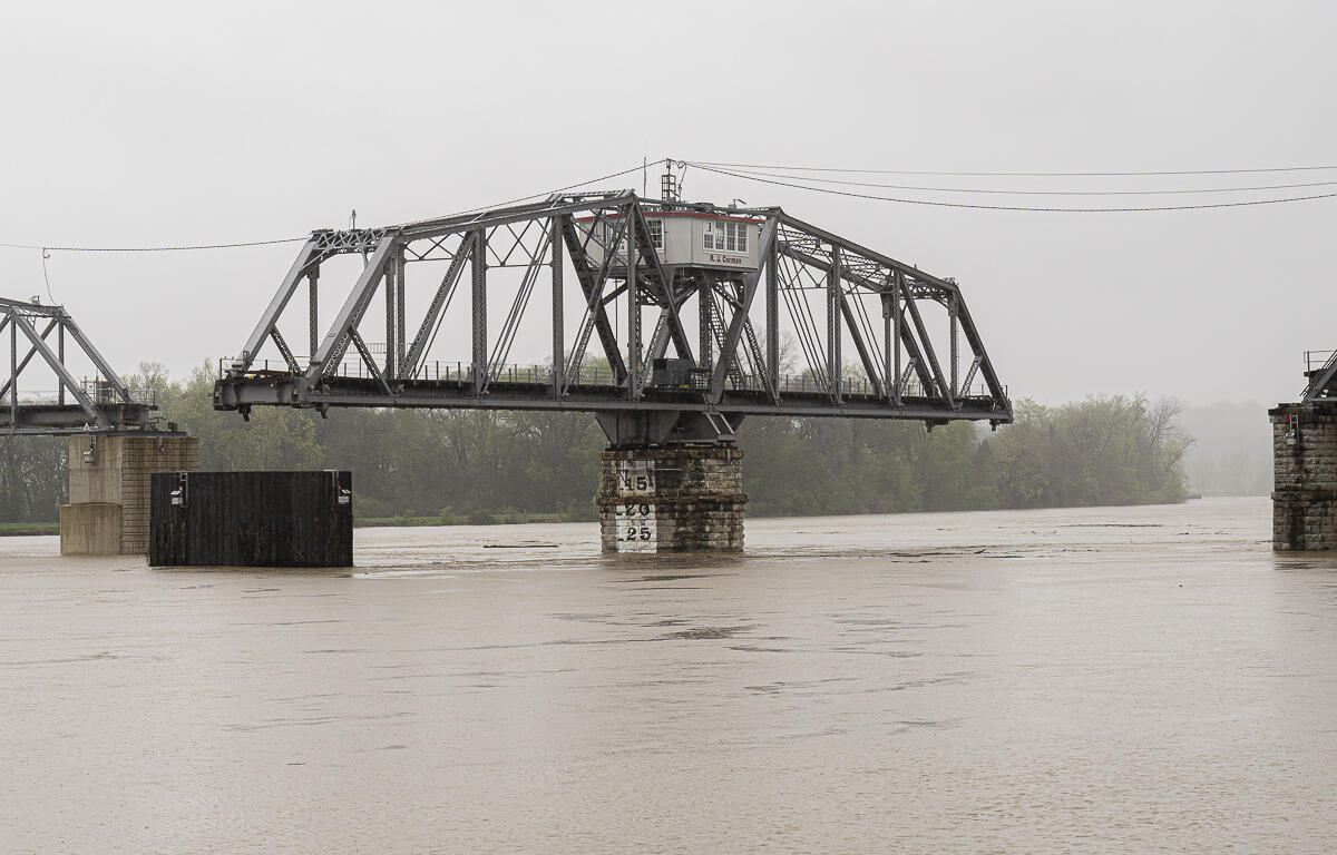
Cumberland River
The Cumberland in Clarksville was at 49.55 feet and rising at 7 a.m. Sunday. Minor flooding is occurring and moderate flooding is about to begin, according to the National Weather Service.
The river will crest at 50.5 feet Sunday evening, and it will begin falling early Monday morning.
For context, the 2010 flood crested at 62.58 feet. The 1937 flood crested at 65.7 feet.
| WEATHER ALERTS: Severe weather alerts for Clarksville today
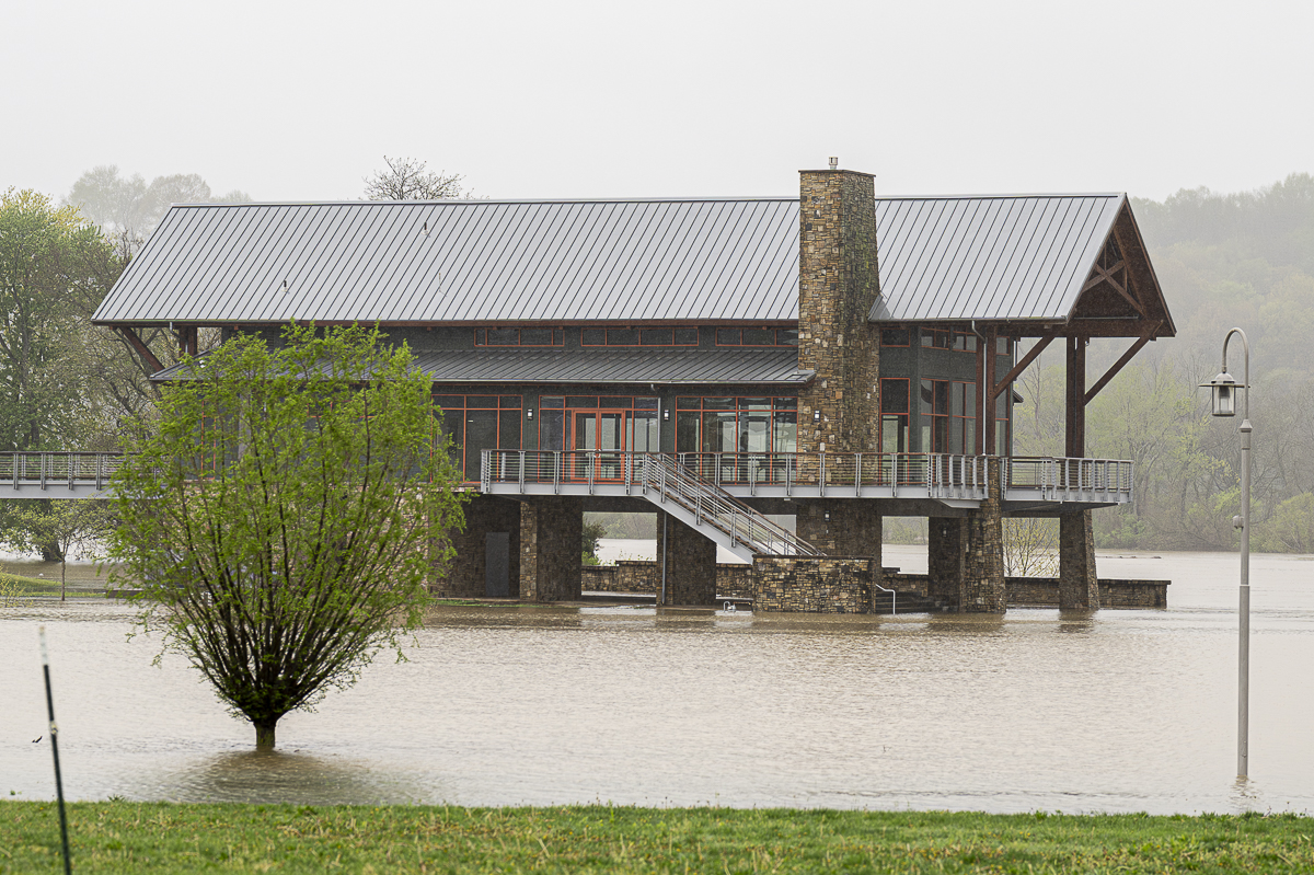
At 50 feet, most agricultural areas along the river flood, as well as many industrial and commercial properties, Riverfront Park and adjacent tributaries. Riverside Drive in Clarksville begins to flood near Highway 48, Providence Boulevard, McClure Street and Cumberland Drive. Also impacted are locations near Quarry Road, Kraft Street near College Street and Providence, Zinc Plant Road, Salem Road and Seven Mile Ferry Road. Water approaches athletic fields near Greenland Farms Drive and properties on Branch Road.
| ROAD CLOSURES: Dunbar Cave Road, Dunlop Lane, Gholson Road and more
Red River
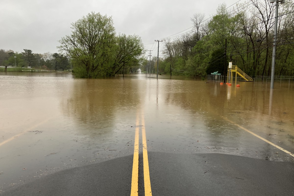
The Red at Port Royal was at 36.95 feet and rising at 7:30 a.m. Sunday. Minor flooding is occurring and major flooding is forecast, according to the NWS.
The river is expected to rise above its 40-foot major flood stage Sunday afternoon, and to crest at 42 feet Sunday evening. It will fall below major flood stage Monday morning, and below flood stage Tuesday morning.
At 40 feet, significant flooding continues to affect areas along the river, including the Red River Valley Park, Port Royal Road near Highway 238, Dunbar Cave Road, which is covered with water, and portions of the Swan Lake Golf Course. Water reaches yards of homes on Rivermont Drive, River Run, Idlewood Drive, and Wimbledon Court.
The Red River, which has no dams, flows into the Cumberland in downtown Clarksville.
| DON’T MISS A STORY: Sign up for the free daily Clarksville Now email newsletter