
CLARKSVILLE, Tenn. (CLARKSVILLENOW) – Rising flood waters along the Cumberland River have been a concern for the community over the weekend.
RELATED: Clarksville-Montgomery County schools will be open Monday
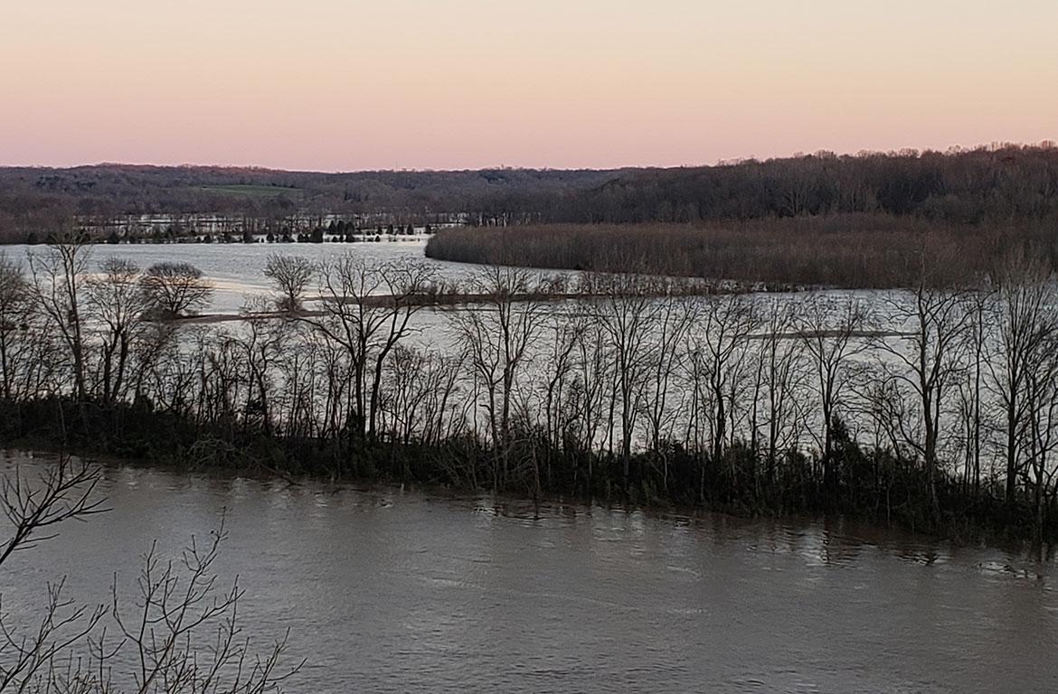
According to Robert Denningham, a hydraulic engineer with the Tennessee Corp of Engineers, the Cumberland River is at 51.07 feet and is expected to crest by midnight tonight at 51.5 feet.
From that point on the level of the water will be released slowly to prevent flooding from happening downstream. By midnight Monday, February 25, the water level should be at 48 feet and reach 41.5 feet by Friday.
“Although we have been in constant communication with the Corp, we thought it best to get the most up-to-date information and communicate it with the public immediately. Emergency Management Agency Director Ed Baggett spoke directly with Denningham this evening. We appreciate the communication with the Corp of Engineers and will continue to update the public of any additional changes,” Montgomery County Mayor Jim Durrett said in a statement.
The flood warning for the Red River in Montgomery County has been downgraded to a flood advisory.
Flood stage in Clarksville begins at 46 feet, which means Clarksville Montgomery County is experiencing some flooding.
RELATED: What does flood stage mean for the Cumberland River?
The Tennessee Emergency Management Agency has issued a state of emergency. Governor Bill Lee said “Our departments and agencies are monitoring the ongoing weather developments in our state and they are coordinating to be fully prepared.”
Our departments and agencies are monitoring the ongoing weather developments and they are coordinating to be fully prepared. Tennesseans should follow the instructions of emergency officials and stay on alert due to rising flood waters and the potential for more severe weather.
— Gov. Bill Lee (@GovBillLee) February 23, 2019
City Departments brace for flooding, storms. Several roads, park areas remain closed as officials monitor conditions. https://t.co/AiyG72jO6y pic.twitter.com/Hj5Rw3hpy9
— City of Clarksville, TN (@ClarksvilleGovt) February 23, 2019
Photos by Lee Erwin – ClarksvilleNow.com
Updated list of road closures:
Lock B South at the river bottoms
Lock B Rd South
Shelton Ferry Rd
Southside Road
CB Road
Lock B North at the bottoms
Lock B North
Gholson Road
Lock C River Bottoms
Lylewood Road at County line
Kirkland Road at Lock C bottoms
Levi Road
Dog Hallow Road
Powers Place
Port Royal Lane
Chapel Hill Road at the bridge over Hurricane Creek
Acuff Road off Dunbar Cave Road
Palmyra Road at Hermitite Road
Hematite Road
Dunbar Cave Road in front of Swan Lake Golf Course
The Montgomery County Sheriff’s Office reminds drivers that it is illegal to drive past road closure barricades/signs and warn against crossing covered roadways.
Regardless of how big your vehicles is, how shallow you think the water may be, or if you can still see the lines on the road. You don’t know if the water has impacted the integrity of the road or the ground underneath it.

For weather updates visit the ClarksvilleNow Weather page, follow us on Facebook and download the ClarksvilleNow app to receive severe weather alerts.


