
CLARKSVILLE, TN (CLARKSVILLE NOW) – The U.S. Army Corps of Engineers said Thursday it is holding back water at the dams in the Cumberland River Basin to prevent flooding farther downstream in Clarksville.
Nashville District reports that its dam projects are operating as designed in the wake of heavy rains that fell overnight and Thursday morning, according to a news release.
Most of the rainfall impacted the Cumberland River downstream of Nashville and unregulated waterways such as the Red River. The Nashville District Water Management Section is working to balance holding and releasing water from its 10 dams to allow rain runoff to make its way through the system and to recapture storage for the next rain event expected Saturday into Sunday.
Water managers are halting releases from storage projects at Wolf Creek, Dale Hollow and Center Hill, said David Bogema, Nashville District Water Management Section chief.
J. Percy Priest releases are forecast to be curtailed Saturday to coincide with runoff moving through Nashville from anticipated heavy rains Saturday into Sunday. He added that the only flows in the system will be the local runoff into Cordell Hull, Old Hickory, Cheatham and Barkley watersheds.
| MORE: Latest storm updates for Montgomery County
Meanwhile, the Cumberland in Clarksville is expected to reach moderate flood stage, which will impact roads and properties along the Cumberland and Red Rivers.
“We are utilizing our flood storage projects to hold back the heavy rainfall they’ve received (in Clarksville) and effectively reduce the flows from 75% of the drainage area above Nashville to zero as additional rains move through the region over the weekend,” Bogema said.
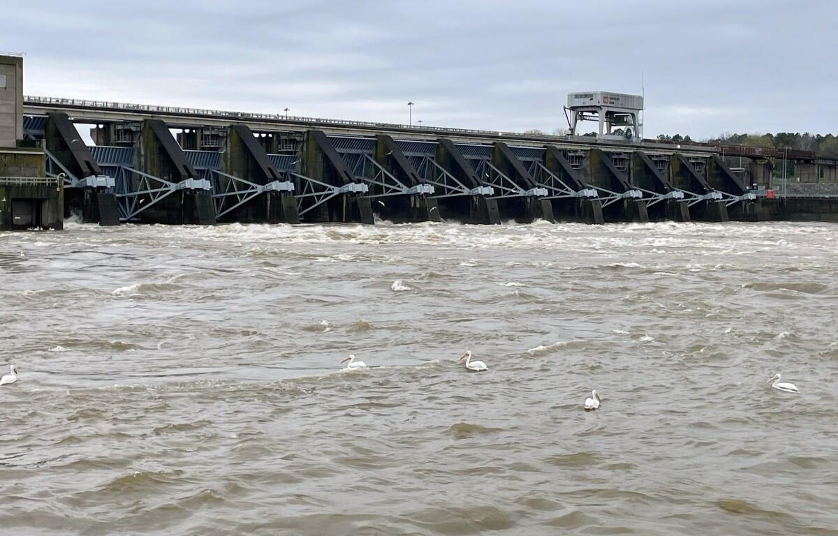
Bogema explained that the large storage reservoirs were designed for this type of operation. Cheatham Dam, just upstream from Clarksville, does not have a flood storage system and must release the water that runs into it.
River flooding forecasts
Flood Warnings have been issued for the Cumberland River at Clarksville and the Red River at Port Royal until 11:45 a.m. Tuesday.
Cumberland River: Minor flooding is forecast, according to the National Weather Service. The river will rise above its 46-foot flood stage Thursday evening, then to 50.9 feet early Friday afternoon. It will then fall to near flood stage Saturday evening. It will rise again Sunday and reach 52.4 feet early Monday morning. It will then fall below flood stage again Tuesday morning.
For context, the 2010 flood crested at 62.58 feet. The 1937 flood crested at 65.7 feet.
At 53 feet, agricultural, industrial and commercial properties flood along the Cumberland River. Portions of Riverside Drive flood between Cumberland Drive and Providence Boulevard and may be impassable, as well as locations near Quarry Road, Kraft Street at College Street and Providence, Zinc Plant Road, Salem Road, and Seven Mile Ferry Road. Water also floods athletic fields near Highway 48 and Greenland Farms Drive, and properties on Branch Road.
Red River: Major flooding is forecast, according to the NWS. The river will rise above its 30-foot flood stage Thursday evening, and to 39.4 feet early Friday afternoon. It will then fall Saturday evening. It will rise to 45.1 feet Sunday evening. It will then fall below flood stage early Tuesday morning.
The Red River, which has no dams, flows into the Cumberland in downtown Clarksville.
| MORE: Road flooding reports coming in, sandbags still available
| MORE: Weather closings: CMCSS closed Friday, APSU remote only
| LOCAL WEATHER: For Clarksville-specific weather updates, sign up for push alerts from our free Clarksville Now app