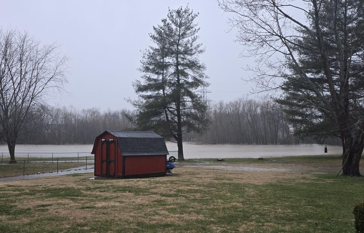

CLARKSVILLE, TN (CLARKSVILLE NOW) – Last month, the City Council narrowly approved the first reading of a proposed rezoning on Old Russellville Pike amid concerns about traffic and flooding.
On Thursday, March 26, the City Council resumed discussion, with Street Department Director David Smith sharing background, not just in recent history, but also data from 1997 and 2010.
Smith shared imagery overviews of the area surrounding Old Russellville Pike starting with 1997. “You can see the footprint of the water on the site there to the north of the apartment complex at Waters Edge Drive, and the lack of development of what is now a commercial site, ” Smith said.
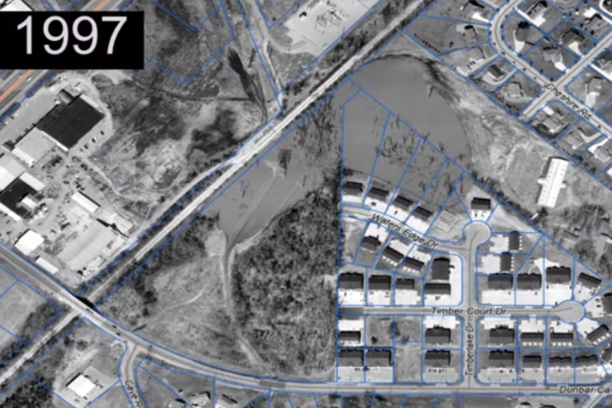
“You can see the crossing on Dunbar (Cave Road), and the tributary that ran underneath and conveyed to the same area. So, you see the there is quite a footprint of water in this area back in 1997, but you can see the subdivision to the northeast is guarded against that.”
| PREVIOUSLY: Rezoning on Old Russellville Pike clears first council hurdle, flooding blamed on clogged pipe
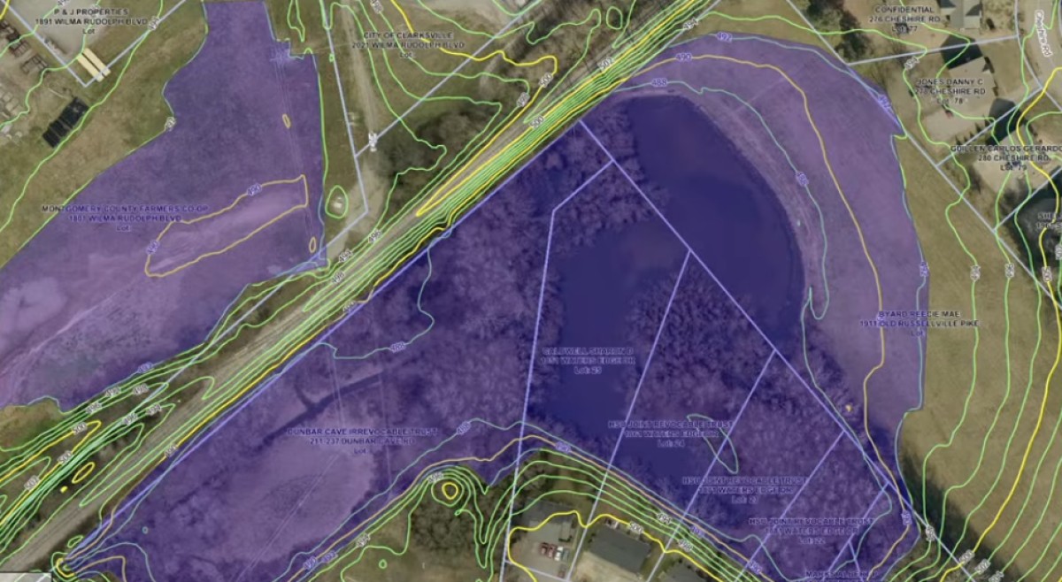
Smith next showed imagery from the 2010 flood in Clarksville. “The 2010 flood, so obviously in recent history the most significant water that this area has seen,” he said.
“You can see the contour of the sediment chasing just past the line on the northeast side, again, not to the homes. Then, again, the two equalization lines shedding water to the east side of the R.J. Corman Line, as it’s designed. But, if you look back between 1997 and 2010, you can see the TVA lines in that area under water. Obviously, it’s a lighter situation in 2010 despite the amount of flooding that occurred.”


Lastly, Smith showed an imagery overview of the Old Russellville Pike area just last year. He said this imagery shows the channelization of the water in 2025 and the TVA area dry.
City takes water off R.J. Corman, later fined by federal agencies
“Some of the history here, at around 1997, R.J. Corman was having issues with that amount of water, putting their tracks under water,” Smith said. He said this took place at the southwest corner of the imagery shown from 1997.
“They had a tremendous issue. … The administration at the Street Department at the time worked within their (R.J. Corman’s) footprint to assist with evacuating this water,” Smith said. “Apparently, it worked a little too well, and it got the attention of the Army Corp of Engineers, and the Tennessee Department of Environment and Conservation.
“What you don’t see here that was referenced in the last presentation by Mr. Tyndall, there is a wet weather conveyance and a blueline stream just off the map to the southwest where that water was proposing to discharge,” Smith said. For their part in working with R.J. Corman to evacuate the water, the city was issued violations by both the Army Corps of Engineers, as well as TDEC.
Smith said in the violations, which came sometime in 2001 or 2002, the agencies defined the area in question a protected wetland, and the area of discharge, where the pipe was sending the water, was in fact a protected wet weather conveyance, and ultimately a protected blueline stream.
Smith said the City of Clarksville and R.J. Corman received a “concurrent wrist slap,” then the corrective action taken was to dam up the work and allow the equalization lines that are in place to do their job.
“In the images we looked at just a few moments ago, that yellow contour line was as far as we saw the water get on the northeast side, and I’ve chased that back 2 feet higher, to a contour that is just beyond that, to explain how the water sheds underneath the railroad tracks through these two lines. Absent any pipe the city installed with R.J. Corman back in 1998.
“The water sheds and equalizes between that basin, and that’s the science behind that basin on the other side not being developed. Wilma Rudolph (Boulevard) also sheds water, the Tennessee Department of Transportation sheds water backward to this area. It’s a low-lying area, through that entire basin that expects subdivision water.”
Stormwater issues with zoning case
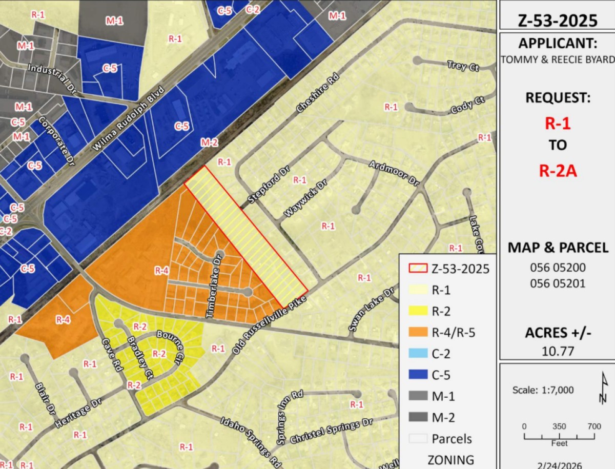
Smith said specifically in this zoning case, looking at its stormwater issues, the developer has determined that a pipe would be installed on Old Russellville Pike that would shed water from the southeast corner of the area to the northwest corner of the pond on the property. He said this would help any stormwater issues existing next to the roadway.
“That’s completely permissible by the standards of those big brother agencies that have been involved,” Smith said. “Moving water to this area not a problem, taking water out of this area, governed by both of those agencies, we don’t have the say-so on that. Nothing that they’ve proposed with that pipe presents an issue.”
As for the pipe that was dammed up by the City of Clarksville and R.J. Corman after being cited for violation, Smith said they don’t have the authority to reestablish the pipe to help evacuate water in that capacity. “That’s not a call for us to make,” he said. “We would have to acquire the easement from (R.J.) Corman to do that, and the list goes on, super complicated. And this was in 2002; I can only tell you the laws that govern some of these protected areas have only gotten stricter over the years.”
Question about digging out basins
Councilperson Joe Shakeenab said he walked the railroad tracks a couple of weeks ago and looked at the property from several angles. He asked if the basins can be dug out even more.
Smith said he hasn’t seen the final plans, but that is the intention. “It’s what we call a compensatory cut. Obviously, they’re going to put down asphalt, rooftops … so anything they’ve taken away to accept water, they’ve got to add that to the ponded area of the corner within their footprint to take on their own water.”
Old Russellville Pike to get upgraded drainage pipe
Councilperson Keri Lovato said with Old Russellville Pike being under water not too long ago, she asked Smith if the implementation of an 18-inch pipe, which was recommended by the hydrology study, would fix the problem and stop the roadway from carrying water again.
Currently, there is a 12-inch pipe installed instead. Smith confirmed and said yes, based off the hydrology report an 18-inch pipe should suffice.
What’s next for rezoning proposal
The Clarksville City Council is scheduled to vote on Thursday, April 2, at 6 p.m. Meanwhile, public comments will be taking place before the meeting, usually between 5:30-6 p.m.
| NEWS TIPS: Do you have a local news tip? Email news@clarksvillenow.com or call us at 931-648-7720.