




Update, 7:30 a.m. Tuesday: Monday’s high reached 91 degrees with a 105 heat index at 3 p.m. It remained that high through 4 and 5 p.m., according to records at Clarksville Regional Airport.
Previously:
CLARKSVILLE, TN (CLARKSVILLE NOW) – With heat index values expected well over 100 Monday and Tuesday, Montgomery County is under a Heat Advisory from the National Weather Service.
The Advisory is in effect through 8 p.m. Tuesday. Today’s high should be 93, with a 106 index; Tuesday should be 96 with a 113 index.
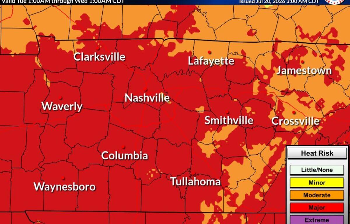
“Hot temperatures and high humidity may cause heat illnesses,” the NWS said. “Drink plenty of fluids, stay in an air-conditioned room, stay out of the sun, and check on relatives and neighbors.”
Clarksville forecast
Here’s the day-by-day outlook:
- Monday: A 30 percent chance of showers and thunderstorms, mainly between 1pm and 2pm. Patchy fog before 9am. Otherwise, mostly sunny, with a high near 93. Heat index values as high as 106. Calm wind becoming west around 5 mph.
- Monday night: Partly cloudy, with a low around 74. Calm wind.
- Tuesday: A 30 percent chance of showers and thunderstorms, mainly between 4pm and 5pm. Mostly sunny, with a high near 96. Heat index values as high as 113. Southwest wind 5 to 10 mph.
- Tuesday night: Showers and thunderstorms before 4am, then a chance of showers. Low around 73. West southwest wind around 5 mph becoming calm in the evening. Chance of precipitation is 90%.
- Wednesday: Sunny, with a high near 86. North wind 5 to 10 mph.
- Wednesday night: Partly cloudy, with a low around 64. North northeast wind 5 to 10 mph.
| WEATHER UPDATES: Click here for seven-day and hour-by-hour Clarksville weather forecasts