
Update, 11:40 a.m.: The National Weather Service has upgraded its alert to a Winter Storm Warning for Montgomery and surrounding counties from midnight Friday through 6 p.m. Sunday.
“Heavy mixed precipitation is expected,” the NWS said. “Total snow and sleet accumulations between 2 and 8 inches and ice accumulations up to one-quarter inch. Expect power outages and tree damage due to the ice,” the alert said. “Travel could be impossible.”
Previously:
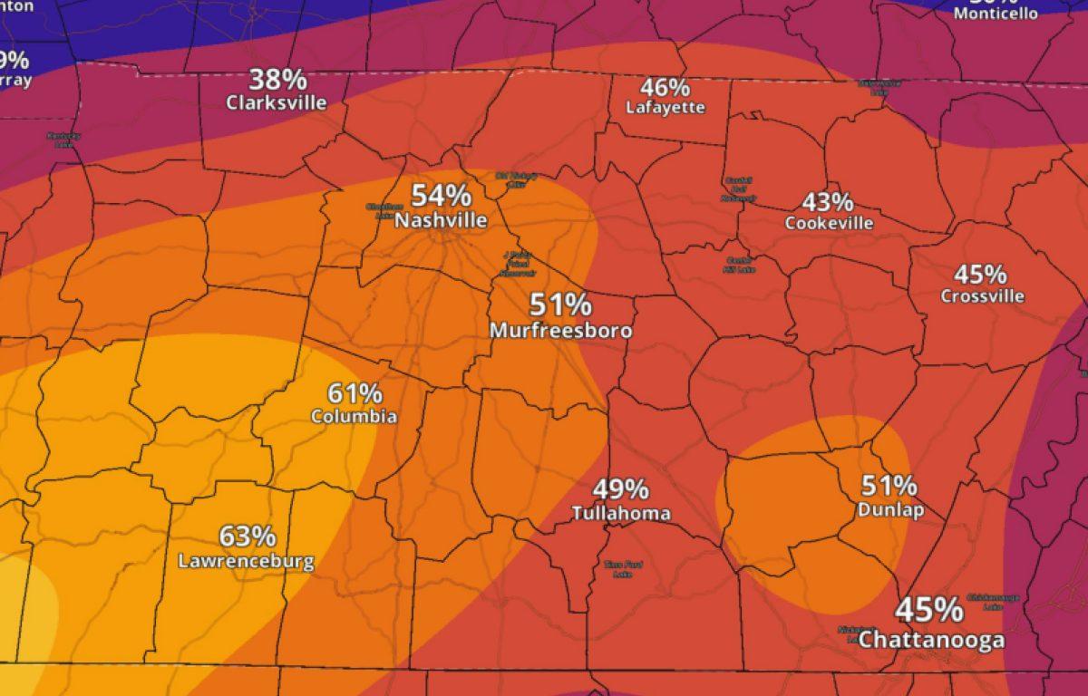
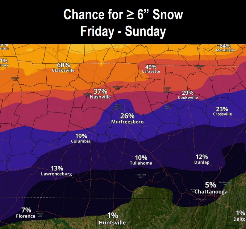
CLARKSVILLE, TN (CLARKSVILLE NOW) – While over 6 inches of snow is still expected, the latest forecasts have increased the chances of severe ice for Montgomery County.
The National Weather Service has issued a Winter Storm Watch for Middle Tennessee from Friday evening through Sunday afternoon. That will likely rise to a “warning” as we get closer to the event.
For Clarksville, there’s a 60% chance of 6 or more inches of snow, and now a 38% chance of a quarter-inch or more of ice, leading to dangerous travel, potential power outages, and possible downed trees and branches.
“While there still remains uncertainty regarding specific snow and ice totals as mixed precipitation is expected to impact the area, forecaster confidence is still high in significant impacts this weekend,” the NWS said.
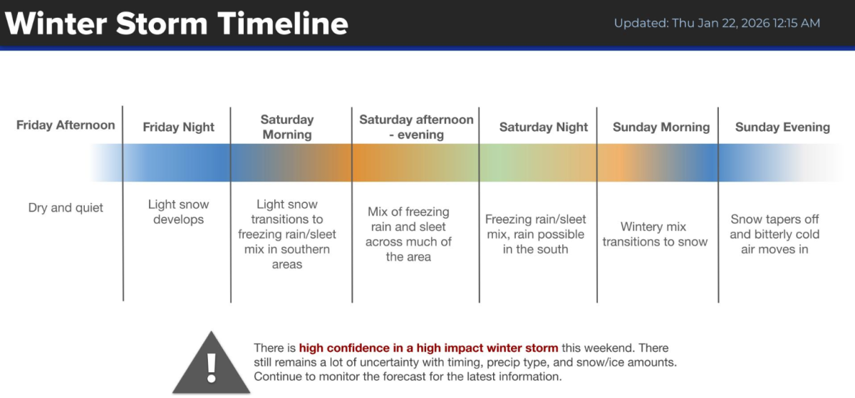
Thursday’s weather should remain calm, so it’s a good day to complete severe weather preparations.
| MORE: 7 most dangerous roads for winter weather wrecks in Clarksville
| MORE: Winter weather: How to handle ice and snow in Clarksville
| MORE: Clarksville, Montgomery County prep for snow, ask residents to stay off streets
Clarksville forecast
Here’s the day-by-day outlook.
- Friday: Mostly sunny with a high near 33. North-northeast wind 10 to 15 mph, with gusts up to 25 mph.
- Friday night: A 20% chance of snow after midnight. Cloudy with a low around 15. Northeast wind 10 to 15 mph, with gusts up to 20 mph.
- Saturday: Snow likely before noon, then snow, possibly mixed with sleet. High near 23. Northeast wind 10 to 15 mph, with gusts up to 20 mph. Chance of precipitation is 100%.
- Saturday night: Snow, possibly mixed with sleet before 9 p.m., then snow between 9 p.m. and 3 a.m., then snow, possibly mixed with sleet after 3 a.m. Low around 17. North-northeast wind 5 to 10 mph. Chance of precipitation is 100%.
- Sunday: Snow likely, mainly before noon. Mostly cloudy with a high near 23. North-northwest wind 5 to 10 mph. Chance of precipitation is 70%.
- Sunday night: Mostly cloudy with a low around 1. Northwest wind 5 to 10 mph.
- Monday: Mostly sunny with a high near 20. West-northwest wind 5 to 10 mph.
- Monday night: Mostly clear with a low around 2.
- Tuesday: Mostly sunny with a high near 34.
- Tuesday night: Mostly cloudy with a low around 16.
- Wednesday: Mostly sunny with a high near 31.
| LIVE VIDEO: Click here for Clarksville traffic cameras