
CLARKSVILLE, Tenn. (CLARKSVILLENOW) – The National Weather Service says the remnants of Hurricane Harvey will begin to affect our weather significantly today and tonight. Rainfall amounts will start to increase overnight.
Heavy rain will persist through Friday as Tropical Depression Harvey moves across Middle Tennessee. Total rainfall amounts through Friday are expected to range between 6 and 8 inches around Clarksville and Land-between-the-Lakes.
A Flash Flood Watch is in effect for Montgomery and surrounding counties through 7 p.m. Friday.
As rainfall amounts accumulate over a period of days, flooding may develop, particularly in areas to the west and north of Nashville.
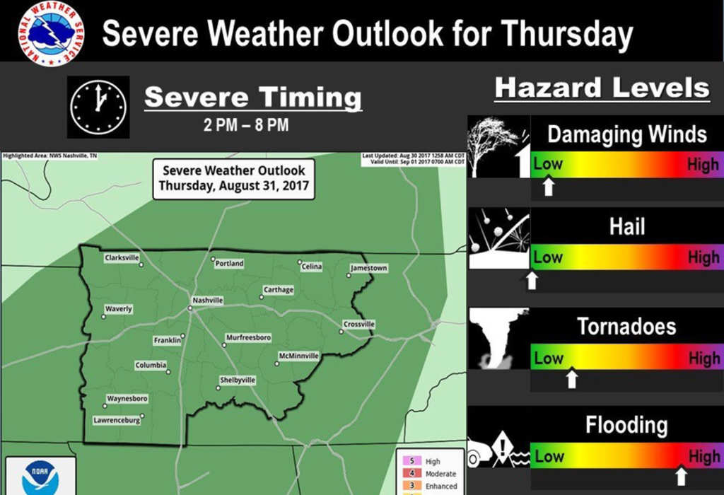
In addition, all of Middle Tennessee is under a marginal risk of severe storms though Thursday night. As the center of low pressure moves directly across the mid state, it is possible that isolated tornadoes may occur, especially Thursday afternoon.
RELATED City prepares for heavy rain, flash floods
The first wave of rainfall today and tonight will moisten soils considerably, but it is the second wave of heavier rains Thursday and Friday that will stand the greatest chance of producing flood problems for the Mid-State. Creeks and rivers may rise and get to action/flood stage Friday through Sunday, depending on timing of heaviest rainfall and if Harvey slows slightly to drop additional rainfall.
In addition, as soils become increasingly saturated over the next several days, local flash flooding could develop, especially in poorly drained low lying areas.
For more weather information, including the 7-day forecast, visit Clarksvillenow.com on Facebook and listen to the following 5-Star Media stations Q108, Beaver 100.3, Rewind 94.3, Z97.5, ESPN Clarksville 104.1, Outlaw 100.7, Sunny 99.1.